
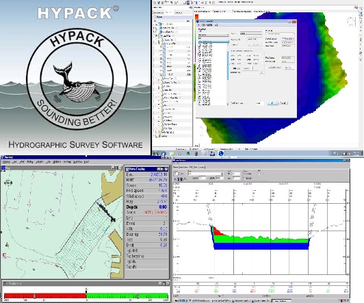
HYPACK
HYPACK, Inc. developed a Windows based software for the Hydrographic and Dredging Industry. Founded in 1984, HYPACK, INC (formerly Coastal Oceanographics, inc.) has evolved from a small hydrographic consultant to one of the most successful providers of hydrographic and navigation software worldwide. HYPACK® is one of the most widely used hydrographic surveying packages in the world, with more than 10,000 users. It provides the Surveyor with all the tools needed to design their survey, collect data, process it, reduce it, and generate final products. Whether you are collecting hydrographic survey data or environmental data, or just positioning your vessel in an engineering project, HYPACK® provides the tools needed to complete your job. With users spanning the range from small vessel with just a GPS and single beam echosounder to large survey ships with networked sensors and systems, HYPACK® gives you the power needed to complete your task in a system your surveyors can master.
Features:
- Data Collection and processing: Single Beam, Multibeam, Side Scan Sonar, etc.
- Full Navigation with AIS Integration
- S57 Chart Update and Real-Time Verification
- Real-time 3D Terrain Model with AVI recording.
- Real-time Altitude for Keel Clearance
- Reports: Sections, Volumes, TIN Models, Plots, Side Scan Mosaic
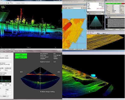
HYSWEEP
HYSWEEP® is an optional module that provides for the calibration, data collection and data processing of multibeam sonar data inside the HYPACK® package. HYSWEEP® has been integrated to almost all multibeam systems, including those from Odom, Reson, Konigsberg/Simrad, Elac/Seabeam, and GeoAcoustics. With over 500 HYSWEEP® users on six continents, HYSWEEP® has proven to be powerful, cost effective and easy to learn.
Although software packages provided by multibeam manufacturers might be great at data collection, they are usually weak when it comes to generating final products. What’s great about HYSWEEP® is that it is fully integrated into HYPACK®, allowing you access to all of the great final product routines, including volume computations using your multibeam data.
Features:
- Multibeam Data Collection/Editing Module.
- Real-time imaging, targeting, QC.
- Powerful Graphical/Automated Editing.
- CUBE data Processing.
- Patch Test Calibration.
- Performance and Statistical Reports.